PavementSense is...

A new Artificial Intelligence powered tool that allows rapid automated data collection and analysis. The system will detect distress, cracks and potholes and give an overall rating to each data point. It will consist of three products, one is a smartphone application for data collection, second one is cloud infrastructure to run Machine Learning algorithms for crack detection and distress rating. And the final product is the web application for monitoring the quality of road networks.
Download Pitch Deck

Why PavementSense?

  • Traditionally, road condition surveys require a lot of manual work which can be automated.
  • Traditional way of road condition survey in Bangladesh takes 5 months (rhd.gov.bd) to complete, which can be decreased significantly. It also lacks crack and potholes detection and a monitoring system.
  • Bangladesh has 17,976 kilometers of road network which needs to be monitored frequently for transportation efficiency. Surveying this amount of pavement currently requires a lot of money and manpower.
  • Using Artificial Intelligence allows a 30% increase in survey accuracy. (Microsoft Research)
  • Roads and Highway department gets the most allocation in the development budget in Bangladesh. In the 2019-2020 fiscal year, 26.1 percent of the total budget was allocated in this sector. Our project will help monitor the road condition better with utmost transparency.

Prototype.

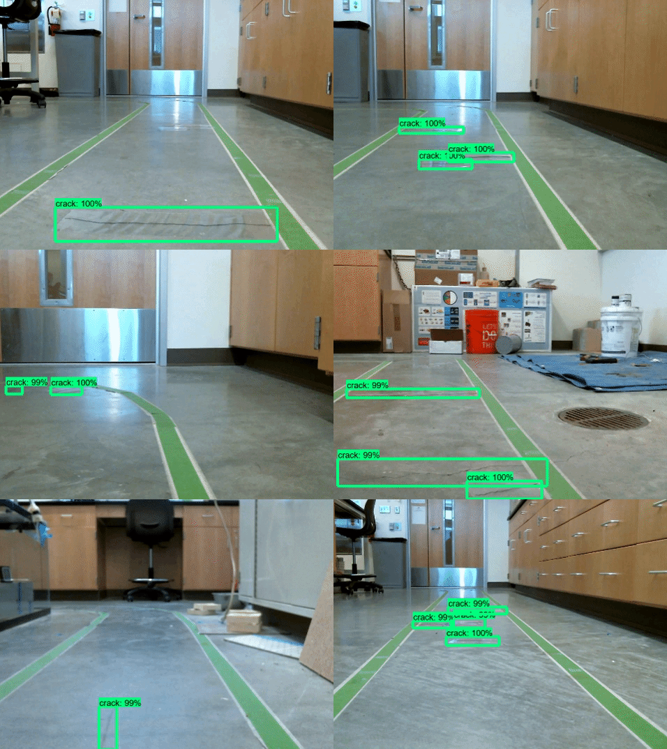
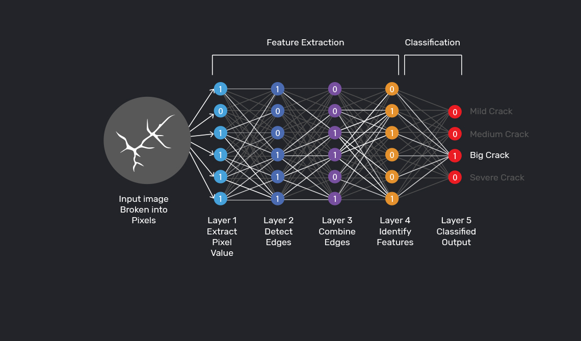
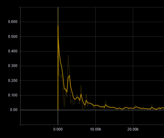
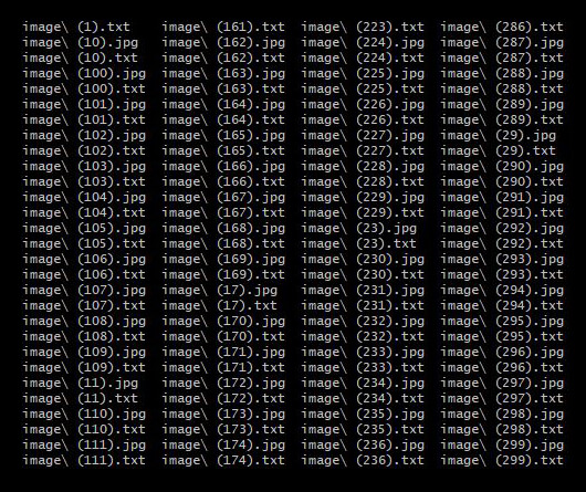
As a proof of concept, we developed a model that can detect cracks on the pavement. The model is developed with TensorFlow API. The architecture of our Deep Neural Network is Single Shot Multibox Detector (SSD). We have trained the prototype model with 600 images and it has proven to be 90% accurate at detecting cracks on the road. Below you can find the structure of a Neural Network, training progress, and final outputs from the Machine Learning model.
Structure of the Deep Neural Network
Localization loss minimization
Collected
data
>

Proposed Monitoring System.

Clear data and imagery of road conditions

Work
in progress.

Progress

1. Develop Android App

We are currently developing an android application for data collection. It will capture images, GPS coordinates and roughness data from the accelerometer every 10 feet.

2. Collect Data for Training

At this stage, we will collect data for Dhaka metropolitan and annotate these for training the Neural Network Model.

3. Train Model

At this stage, we will use the annotated data to train our Neural Network model. This will be very resource intensive work, we will need a powerful GPU server for executing this in a timely manner.

4. Detect Features and analyze Outputs

This will be the final stage. We will feed test data into the model for feature detection and road condition score projection. Then we will upload this data to the web application for end users to analyze further.


0
KM Road Network
0 %
Increase in survey accuracy
0 %
of National Budget invested
0 %
Prediction Accuracy

Meet our team.

Maruf Ahmed
Co-founder and CEO
Research Assistant - Machine Learning @ BSU
Computer Science BS, Boise State University
Nabil Rahman
Co-founder and CTO
Human-computer Interaction Engineer @ MetaGeek
Computer Science BS, Boise State University
Shahriar Ahmed
Co-founder and ML Engineer
Computer Science BS, Daffodil International University
Fazle Rabbi
Co-founder and CFO
Bachelor of Business Administration
@ IBA, JU